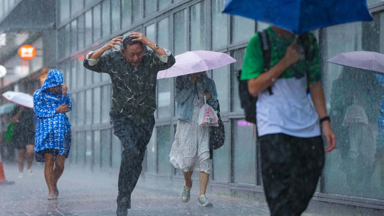
Hong Kong did not just get wet in July 2026. It got drenched.
In the first 20 days of the month alone, the city recorded a whopping 474.7 millimeters of rainfall. That figure easily blows past the normal full-month average of 385.8 millimeters by roughly 23 percent. Think about that for a second. With a full third of July still remaining on the calendar, the city had already shattered its monthly quota.
The sudden deluge left commuters wading through waterlogged streets, triggered widespread flash flooding, and sent viral clips of surging rivers across social media. The Hong Kong Observatory issued 48 rainstorm warnings between early June and mid-July, nearly double the count from the exact same timeframe a year earlier.
If you're asking why this happened, the short answer comes down to a stubborn atmospheric setup: a persistent, stationary trough of low pressure hovering over southern China, squeezed and energized by nearby tropical cyclone activity. But the deeper story touches on global weather patterns, shifting atmospheric jet streams, and how city life buckles under relentless downpours.
The Numbers Behind the July Deluge
July in Hong Kong usually follows a familiar pattern. Early July typically brings a stretch of hot, sunny days as sub-tropical high pressure holds firm over the region. Short afternoon showers pop up, but prolonged, multi-day rainstorms are generally reserved for peak typhoon occurrences later in August or September.
This year flipped the script entirely.
Hong Kong Observatory data shows that rain poured continuously over the territory during what should have been a relatively dry mid-summer window. Rain gauge readings across the New Territories and Lantau Island regularly logged intensity levels that triggered multiple amber and black rainstorm alerts within span of days.
Normal July Monthly Rainfall (Average):  385.8 mm
July 2026 Rainfall (First 20 Days):     474.7 mm (+23%)
Rainstorm Warnings Issued (June-July):  48 total (Nearly 2x last year)
Notice how steep those totals are. Receiving over 470 millimeters of rain in three weeks means the ground across Hong Kong's steep hill slopes remained constantly saturated. That drastically increased the risk of landslides, overburdened urban drainage networks, and forced temporary school closures across multiple districts.
What Caused the Relentless Downpours
Meteorologists track heavy weather using structural dynamics in the upper and lower atmosphere. Hong Kong Meteorological Society spokesman Leung Wing-mo explained that the recent surge in rain was driven by a broad trough of low pressure that essentially got stuck over the northern South China Sea and southern coastal provinces.
A low-pressure trough acts like an atmospheric vacuum. It pulls warm, moisture-laden ocean air upwards into cooler altitudes. As that humid air rises, it cools rapidly, condenses, and dumps massive volumes of rain.
Three primary weather mechanisms converged to keep this rain machine running nonstop:
The Lingering Trough from Super Typhoon Bavi
Before the July rains settled over Hong Kong, Super Typhoon Bavi struck Fujian and Zhejiang provinces further north along China's eastern coastline. As Bavi made landfall and gradually dissipated, its sprawling circulation did not simply vanish. Instead, it left behind an elongated trough of low pressure stretching across mainland China. This structural trough migrated south and anchored itself over Guangdong province and the South China Sea for eight to ten straight days.
Indirect Friction from Tropical Storm Maysak
While the low-pressure trough was parked overhead, Tropical Storm Maysak began churning in the South China Sea. Although Maysak moved toward Guangxi rather than striking Hong Kong directly, its spin funnelled massive amounts of tropical moisture straight into the lingering trough over southern China. The storm essentially acted as an atmospheric fuel pump, feeding continuous bands of heavy thunderstorms into the city.
Unstable Air Masses Clashing Overhead
Summer weather in southern China is driven by moisture contrasts. When cold air troughs from central China nudge southward and collide with warm, tropical monsoonal flow from the South China Sea, the boundary between them turns volatile. In mid-July 2026, that boundary sat right on top of the Pearl River Delta.
Why Storms Stall Longer in a Warming World
Is this continuous rain just bad luck, or part of a bigger trend? Honestly, it's both.
Meteorologists and climate scientists point out an unsettling atmospheric shift: heavy weather systems are moving markedly slower than they used to.
When global average temperatures rise, polar regions warm faster than equatorial zones. This reduces the temperature differential between the equator and the poles. Because that temperature gap drives high-altitude winds like the jet stream, a smaller gap weakens the jet stream.
A weaker jet stream means high-pressure ridges and low-pressure troughs lose their steering currents. Weather patterns get stuck in place—a phenomenon scientists refer to as atmospheric blocking or quasi-stationary weather systems.
When a dry system gets stuck, you get prolonged heatwaves and intense droughts, much like the severe heatwaves seen across North America and Europe. But when a rain-bearing trough gets stuck over a tropical coastline like Hong Kong, you get non-stop, multi-week downpours that smash monthly climate records in a fraction of the time.
The Strange Patchwork of Localized Rainfall
Have you ever walked out of a subway station in Mong Kok under torrential rain, only to take a 15-minute train ride to Central and find dry pavement?
That weird variation happens all the time in Hong Kong, but during intense trough conditions, it becomes even more pronounced.
As Leung Wing-mo pointed out, a low-pressure trough provides the general atmospheric background for heavy showers, but it does not dump rain uniformly across every square kilometer. Downpours occur in localized convective cells.
When a cloudburst releases its moisture over a specific district—say, Sha Tin or Tai Po—it consumes huge amounts of energy and atmospheric water vapor. The atmosphere literally needs time to "breathe" and recharge before another storm cell can form nearby. That creates short breaks of sunshine or dry weather right next to areas getting hammered by torrential rain.
Hong Kong's dramatic geography amplifies this effect. When moist air hits steep landforms like Tai Mo Shan or Lantau Peak, the air is forced upward abruptly—a process known as orographic lift. This triggers cloud formation right along mountain ridges, which is why hilly regions in the New Territories often log far higher millimeter counts than urban flatlands along Victoria Harbour.
What Continuous Rainstorms Mean for City Life
When nearly 500 millimeters of rain hits a densely populated metropolis in 20 days, the impact goes way beyond wet umbrellas.
Infrastructure and Drainage Strain
Hong Kong features one of the most advanced urban drainage systems on Earth, including massive underground flood storage tanks beneath Happy Valley and Tai Hang Tung. Yet, relentless multi-day rain keeps drainage catchments full. Soil on steep hillsides becomes completely saturated, drastically raising the risk of mudslides and retaining wall collapses.
Outdoor Workers Face Extreme Hazards
Continuous weather alerts disrupt daily operations for tens of thousands of outdoor workers. Construction crews, sanitation staff, and food delivery couriers face hazardous conditions on slippery roads. While Hong Kong authorities updated the Code of Practice for rainstorm and extreme heat conditions, labor groups emphasize that advisory safety guidelines still lack the binding power of statutory workplace laws.
Commuter and Transit Chaos
Repeated rainstorm signals force sudden schedule adjustments for ferries, buses, and outdoor MTR rail segments. Morning warning updates force working parents and schools into rapid shifts between online learning and physical classes.
Practical Steps to Prepare for Prolonged Rain Events
Living through Hong Kong's wet season requires a proactive mindset, especially when long-lasting weather troughs take hold over the region. Here is how to keep yourself, your home, and your daily routine safe when extreme rainfall strikes:
- Track real-time rain radar, not just daily forecasts. Download the "MyObservatory" app and check the 64-kilometer rainfall radar map. Generic daily forecasts might say "showers," but radar maps reveal exactly where severe storm cells are heading over the next 30 to 60 minutes.
- Inspect home window seals and air-con drain pipes. Prolonged wind-driven rain penetrates degraded silicone seals around high-rise windows, causing interior water damage. Clear drainage trays around window-mounted air conditioners to prevent backflow into rooms.
- Avoid hiking trails and slope bottoms during amber alerts. When soil saturation reaches critical mass after weeks of rain, slopes can give way without warning, even hours after heavy rain stops. Stay clear of steep, unpaved terrain and retaining walls.
- Know your employer's extreme weather policy. Familiarize yourself with how your workplace handles Amber, Red, and Black rainstorm warnings, including commute expectations when warnings are lowered mid-day.
- Keep emergency gear packed and dry. Maintain a water-resistant bag with power banks, emergency contact numbers, and basic rain gear if you commute through low-lying areas prone to sudden flash floods.
As climate patterns continue to bring slow-moving, high-intensity rain systems to southern China, extreme rainfall events like July 2026 won't be isolated anomalies. Staying informed through local meteorological data and preparing for sudden urban flash flooding remains your best line of defense.